Thursday 26 March 2015

Investigating Archeological Sites

Archeological sites are a hot topic in the news these days. They can be controversial, but they are an essential part of developing property these days on the coast of BC so it is important to know what needs to be done.

Some properties have already had assessments done and have marked archeological sites on them. Understanding the implications of these sites is important, as an owner, or potential owner, needs to know what can and can't be done with the property.

 You can first determine if there are any known sites on the property by contacting the provincial government through their Archaeology Branch. This is something that we at BC Oceanfront, a part of the Royal LePage Advance Realty team, do on most of our listings. We have found the Arch. Branch to be very easy to deal with, and the forms required are straight forward to fill out. We submit directly from online.

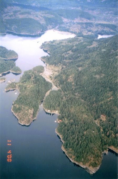
Round Island has known archeological sites.

If you wish to build on a property or make major alterations to a property, then an archeological assessment is generally required. Most municipalities and regional districts will require an assessment during the permitting process.

From the Archaeology Branch's FAQ document, these are two things they see as important to property owners: "The current use of the property is seldom affected unless the use involves significant land alteration. A house on a fully developed lot is not affected by overlapping with an archaeological site. An active gravel pit is a concern, because this current use will damage or destroy a site.
New development, such as changing the building footprint, major landscaping, or installation of an in ground swimming pool, will be a concern, because the new activity may damage the archaeological site. When planning for land use change, ensure that a professional consulting archaeologist is part of the planning process. They can determine if the new development will have an effect on the archaeological site.
In many cases, the archaeological site is not within the development zone. As an example, sites on waterfront properties are usually close to the water and are often contained within zoning setbacks set up to protect other environmental values."


Owning property on the BC Coast is a dream for many, and it is important to have all the information on hand when making those dreams reality.

It's a Coastal Lifestyle ... Pass It On!

Thursday 19 March 2015

BCO Coastal Gems: Sonora Island

Sonora Island is one of the larger islands in the Discovery Islands Group, with a land mass of 30 square km and several mountain peaks. It is also one of the more northern of the island group.

Sonora is known for its world class resort, Sonora Island Resort, as well as some of its larger exclusive estates. There are also small land holdings here, typical of all the Discovery Islands.


The island is surrounded by rapids, including Hole in the Wall between Sonora and Maurelle Islands - a favourite with locals and tourist boat groups - and the Yaculta Rapids. They feature drops, whirlpools and fast water.

Access to Sonora Island is by boat or float plane as there is no ferry service. In the summer there is regular water taxi service from Campbell River.

It's a Coastal Lifestyle ... Pass It On!

Thursday 12 March 2015

Aerial Photography in the BCO Office

Whenever Ed goes out to look at a property by plane, we hand him a list of properties we would like aerial photos for. Some of them will be properties that we want fresh photos of - maybe the first ones were taken on a really grey day, or in winter (so not as green) or only from one angle. Some of them will be new properties.

Gorge Harbour, Cortes
Aerial photos have long been standard in Ed's listings, and are a big help in showing remote properties. They allow clients to get a good look at a large property and allow us to provide some idea of property dimensions and boundaries.
Lot A West Rd, Quadra with and without property lines

When Ed comes back to the office we sit down at one of the computers and go through the photos, sorting them into the property folders so that they can they be incorporated into the respective listing.

Read Island
Sometimes though the best photos are the ones Ed takes in between properties, or the ones he takes as an afterthought. Some of those are our favourites.


It's a Coastal Lifestyle ... Pass It On!

Thursday 5 March 2015

Coastal Gems: Desolation Sound

Desolation Sound, a name recognized world-wide, is one of the most beautiful areas along the British Columbia mainland coast. Naturally beautiful and diverse, the area is also known to have some of the warmest summer time ocean temperatures anywhere along the west coast of Canada. The predominately calm waters of Desolation Sound are home to a variety of indigenous marine wild life and the mainland with some of its most spectacular inlets such as Toba inlet to the north about 10 miles, is home to all types of mainland wildlife.

 This is a popular region with boaters, and access to the region from local communities providing a variety of services is relatively quick and easy. Lund with marina facilities and road access to Powell River is located approximately 15 miles south and east from the properties and Campbell River on Vancouver Island is approximately 28 miles to the southwest.  

Another great region to explore.

It's a Coastal Lifestyle ... Pass It On!